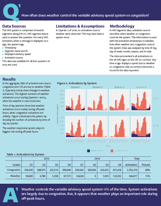
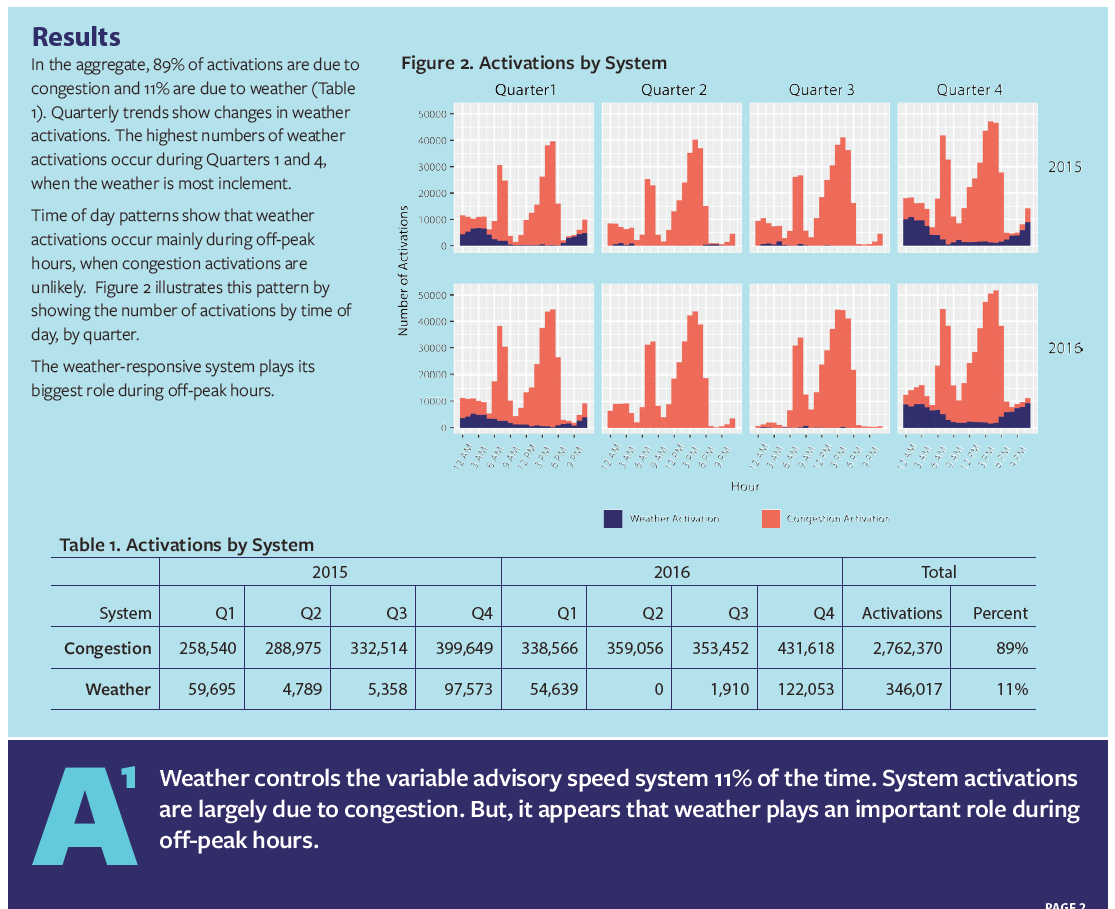
This project evaluated the weather-responsive component of the Active Traffic Management system on the OR 217 highway corridor between Beaverton, OR and Tigard, OR. In short, the active traffic management system uses real-time data from traffic and weather sensors along the highway to change advisory speed limit signs (more info here). The intent is for drivers to see the speed limits and adjust to safe travel speeds before they encounter congestion or adverse weather.
This evaluation project was focused on answering three questions:
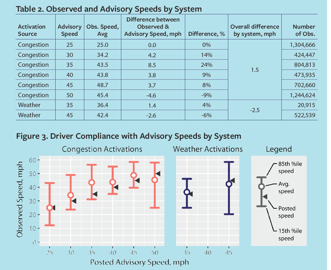
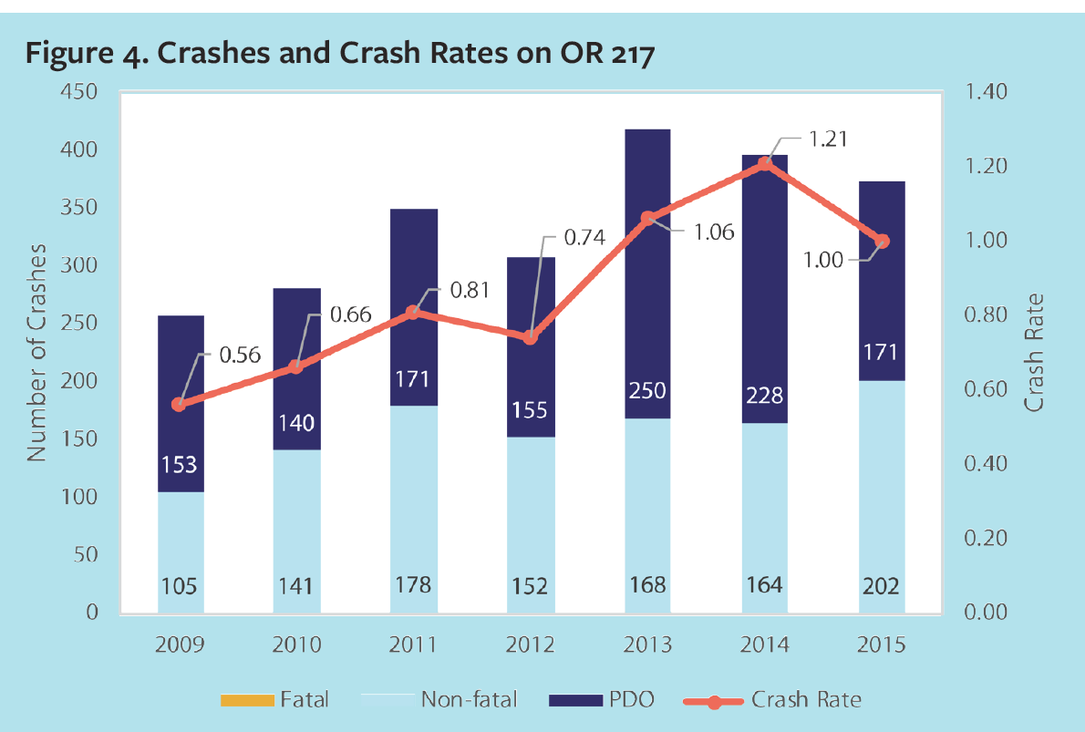
To answer these questions, I gathered, transformed, and combined data from the OR 217 system, traffic speed data from a separate system, and crash records for the years of interest from a crash database. The results revealed interesting patterns on how the system operates and how drivers interact with it. The data also showed that this kind of system is providing safety benefits by reducing traffic crashes and the crash rate (crashes controlling for traffic volume).
I worked with a communications designer to package this evaluation in a short, easy to digest report. You can see some images from the report below.
The report was well received. The client provided this feedback:
Overall, the report is depicted in an easy to read format that made analyzing the data very easy. We appreciate the time and effort you have put into this and we hope to see reports similar to this format in the future.
Available on request